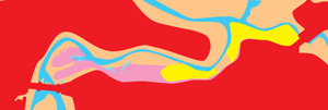
When I first moved to where I currently live, Ravenglass, I was amazed by the quantity of water that came and went with every turn over the tide.
With interest in the use of contours in OS maps to achieve a sensation of height ganied and lost and after years of using contours in competitions and mountaineering I was curious if I could use the principle to illustrate the same in water movement in and out of the estuary.
Not sure if I quite achieved what I set out to, but I quite like the results.


